Forterra 30 Acres in Roslyn, WA
Forterra purchased the historic No. 4 Mine property — a 30-acre parcel that sits within Roslyn’s city limits and historic district, adjacent to the Coal Mines Trail, and directly behind City Hall and the fire station. The property was originally purchased from Suncadia Resort after the Roslyn Downtown Association reached out to Forterra about the opportunity in 2017.
If you feel any information on this page is incorrect or out of date, please let us know — corrections are made promptly.
Update: 10/13/2026 – The City of Roslyn has now received a formal cleanup application for this site (filed July 20, 2026), and Forterra’s own engineering plans contradict what I was told in April. Their Cleanup Action Plan, dated August 11, 2025, eight months before Forterra told me by email they had no building plans, states a specific redevelopment plan: approximately 13.4 acres for “attainable housing” and approximately 17 acres preserved for community benefit and natural space. See the updated sections below, each linked to the actual state cleanup record rather than secondhand summaries. The original 4/29/2026 note is preserved in Update History near the bottom of this page.
Roslyn and Cle Elum are neighboring towns connected by SR-903. Cle Elum has its own large undeveloped parcel nearby — Pine Ranch/Bullfrog Flats — that has raised similar questions about what a big site can become once zoning and funding line up. See our coverage of that project for comparison: 47 Degrees North / Pine Ranch — Bullfrog Flats.
Potential Negative Impacts for Roslyn, WA Residents
Environmental Concerns – What’s in the Ground?
“…the land polluted with hazardous heavy metals and petroleum hydrocarbons.“
— Forterra
What Are “Hazardous Heavy Metals and Petroleum Hydrocarbons?”
Forterra secured a $1.78M EPA Brownfields Cleanup Grant — which means the federal government itself agreed that contamination at this site poses a risk serious enough to fund remediation. Two decades of actual soil and groundwater sampling (2004-2025) have since confirmed the specific contaminants, rather than leaving it a guess:
- Confirmed chemicals of concern in soil: arsenic, cadmium, lead, mercury, zinc, and oil-range petroleum, all exceeding Washington’s MTCA Method A cleanup levels in at least some tested locations
- Groundwater: arsenic at one monitoring well (MW-02) measured 35 to 55 micrograms per liter across two separate sampling rounds, well above both the state cleanup level (5 ug/L) and the natural background level for the region (6 ug/L)
- Lead near the former foundry tested at 9.7 mg/L in federal hazardous-waste testing (TCLP), above the EPA’s 5 mg/L regulatory threshold, meaning some of this soil may need to be handled and disposed of as a federally regulated hazardous waste, not routine contaminated soil
- Chromium, benzene, and toluene were also tested for but did not exceed applicable cleanup levels, so they are not officially carried forward as chemicals of concern for this site
Source: Cleanup Action Plan, Roslyn No. 4 Mine (Maul Foster & Alongi, Inc., August 11, 2025), hosted directly by the Washington State Department of Ecology.
How could you be exposed during cleanup/construction?
- Breathing contaminated dust stirred up during excavation
- Contaminated runoff entering Roslyn’s water or the adjacent wetlands
- Kids and pets playing near active dig zones
- Workers and nearby residents absorbing airborne particles
Two separate phases, worth not conflating: the cleanup itself is a short, bounded project, about 500 cubic yards of soil removed, with construction estimated at under 8 weeks sometime between Fall 2026 and Fall 2027. Any actual housing construction on the 13.4 acres described below would be a separate, later phase with no confirmed start date. The impacts below reflect both phases; where it matters, we’ve tried to say which one.
What Forterra’s Own Filed Plans Actually Say
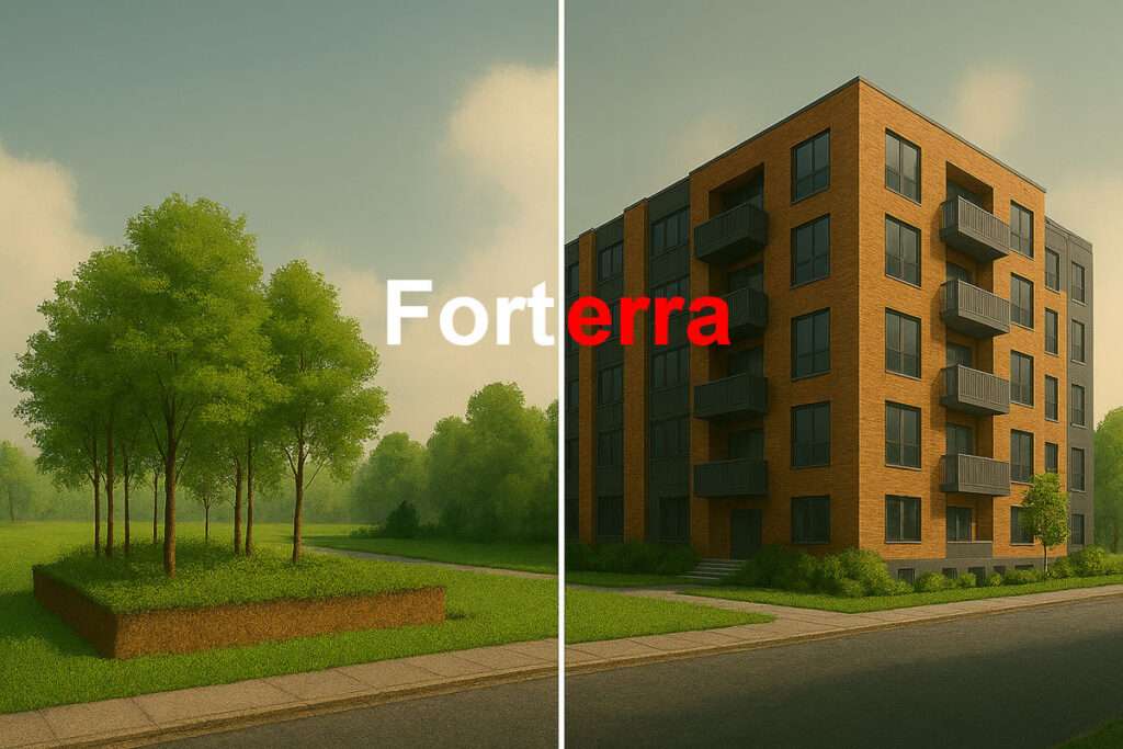
The Cleanup Action Plan states a specific redevelopment plan for this property: approximately 13.4 acres developed with attainable housing, and approximately 17 acres preserved for community benefit and natural space. The cleanup design is already being built around this plan, part of one excavation area is being left unbackfilled specifically because it will become a roadway for housing access. Source: Cleanup Action Plan, Roslyn No. 4 Mine, Section 3.3 and Section 6.
The funding behind this is also now specific and traceable. Forterra’s cleanup work is funded through a Washington State Department of Commerce Capital Agreement, contract No. 24-62310-001, effective June 3, 2024, explicitly described as supporting “environmental site assessment, analysis of cleanup alternatives, and site planning for redeveloping the Property with attainable housing for community benefit.” Source: same Cleanup Action Plan, Section 1.1. The original 2020 purchase of the property was itself funded by a separate, earlier grant: a “Local Community Projects” capital-budget earmark sponsored by state Senator Judy Warnick in 2019 legislation, which covered Forterra’s due diligence and the purchase itself. Sources: Forterra press release and Daily Record.
The site is enrolled in Washington Ecology’s Voluntary Cleanup Program (VCP), currently listed as “Awaiting Cleanup,” with Ecology issuing a July 31, 2025 opinion that no further remedial action will likely be needed (an NFA determination) once the proposed cleanup is complete (with a possible environmental covenant if contamination remains under a soil cap). The Cleanup Action Plan states it follows WAC 173-340-400 and 173-340-380. You can track this site’s status and every document in its file directly: Washington Department of Ecology Cleanup Site Search, Site ID 15545.
The Formal City Review, Where It Stands
Separate from the state Ecology process above, the City of Roslyn is running its own SEPA (State Environmental Policy Act) review. Forterra filed the formal cleanup application on July 20, 2026; the City determined it complete on August 17, 2026; and the City issued its preliminary SEPA notice on September 17, 2026, opening a preliminary public comment period through October 16, 2026. The City states it expects to issue an MDNS (mitigated determination of nonsignificance), not a full determination of significance. Source: City of Roslyn, Notice of Preliminary SEPA Action. Important: this is not the public’s last opportunity to weigh in. The notice itself states this preliminary comment period “does not itself establish or replace any comment, notice, scoping, or appeal period that applies to a subsequent final SEPA determination.” Once the City issues its actual threshold determination, a separate, required 15-day comment period follows, with notice published in the City’s newspaper of record per RMC 18.40.015(F)(1). City Planner Michelle Geiger confirmed this directly on October 14, 2026.
The Washington Department of Fish and Wildlife (WDFW) filed a comment during that window. Its October 2, 2026 letter confirms the property includes Crystal Creek and two tributary streams, asks the City to clarify whether haul routes, staging, or stockpiling will occur within the streams or their riparian buffer, and states plainly: “As future development is proposed on this property, WDFW recommends early coordination to ensure Fish and Wildlife Habitat Conservation Areas are protected.” That is a state wildlife agency treating future housing on this site as an expected next step, not a hypothetical. Source: WDFW comment letter, October 2, 2026.
Does the City’s Own Housing Plan Rely on This Site?
We checked. As of the City’s draft 2026 comprehensive plan update, no. We reviewed the full Comprehensive Plan and its Housing Technical Appendix directly and found no mention of Forterra, the No. 4 Mine, or the Dakota Avenue parcel anywhere in the City’s housing planning materials. On the question of using donated or surplus land to help meet affordable housing targets, the plan states plainly: “The City owns very limited vacant land.” That is the City’s own planning document saying it isn’t counting a privately owned parcel like this one as part of how it meets its own state-mandated housing obligations (178 units below 50% of area median income by 2046, under the Growth Management Act (GMA)). If that changes in a future plan update, we’ll note it here. Sources: City of Roslyn draft Comprehensive Plan (June 2026) and Appendix D, Housing Technical Appendix.
Increased Tax Burden for Infrastructure Upgrades
- New development will likely require expanded water, sewer, and road infrastructure, which could lead to higher property taxes or utility rates to fund these improvements
- The city may need to invest in stormwater management systems due to the site’s proximity to wetlands
Fire Department and Emergency Services Strain
- This is a later-phase concern tied to actual housing construction, not the current cleanup: additional housing and commercial space would increase demand on Roslyn’s small fire department and emergency services, potentially requiring new equipment, staffing, or facilities—again, likely funded by local taxpayers
Pressure on Limited City Resources
- Roslyn is a small town with limited administrative capacity. Managing a large-scale development project could divert city staff and resources from other priorities
Gentrification and Displacement Risks
- While the project aims to provide “attainable housing,” the influx of new residents and development could drive up property values and rents, making it harder for long-time residents to afford to stay
Possible Traffic and Parking Challenges for Number 4 Mine remediation
- Increased population and commercial activity may lead to traffic congestion and parking shortages, especially near the historic downtown and Coal Mines Trail
- SR903 is only 2 lanes – What happens if there is a major emergency requiring residents/tourists to vacate on a single lane while first responders have to come in on a single lane and there is large vehicles and/or equipment using the same 2 lanes?
- Granted, there are backroads, but for the most part, SR-903 is the main paved road into and out of Roslyn for large trucks and equipment.
What the cleanup itself actually involves (confirmed, not hypothetical):
- Excavation equipment: track excavators and loaders accessing the site during active dig phases
- Heavy haul trucks: approximately 500 cubic yards of impacted soil will be removed and transported to a licensed off-site disposal facility, some of it likely meeting the federal threshold for hazardous waste, meaning a bounded but real series of loaded haul truck runs out of Roslyn via SR-903, over an estimated construction window of less than 8 weeks
- Traffic control: depending on the access configuration, single-lane traffic control on SR-903 near the access points may be required during equipment moves
- Keep in mind: they “could” go in and out via the Coal Mines Trail or South A St. aka: Duck Town – That might be great business for Carek’s Meat Market if they have places for large trucks and equipment to park.
Uncertain Long-Term Costs
- Even with grants (e.g., the $1.78 million EPA Brownfields Cleanup Grant), long-term maintenance and operational costs for new parks, green spaces, or public facilities may fall on the city and its residents
Worth noting: Ecology has already indicated no further remedial action will likely be needed once this cleanup is complete, so the active cleanup-related costs and oversight appear bounded. What remains genuinely open-ended is who pays for maintaining whatever gets built on the 17 preserved acres and the 13.4 housing acres afterward, that part is not yet determined.
Community Division Over Development
- While some residents support the project, others may oppose it due to concerns about preserving Roslyn’s small‑town character and its historical society–recognized heritage, potentially leading to community tension or political conflict.
“I am grateful to the Bipartisan Infrastructure Law we passed and President Biden signed, and to the EPA for this investment to clean up contaminated land in Roslyn,” said Rep. Schrier. “The city will benefit greatly from turning this property, vacant for fifty years, into a community asset. This funding will provide family wage jobs and bring economic opportunity to Roslyn.”
— Congresswoman Kim Schrier
Questions Roslyn Residents Should Be Asking Forterra and City Officials:
- What independent environmental testing has been done, and who paid for it?
- Who monitors air and water quality during the cleanup — and will results be publicly posted?
- What happens if contamination spreads during excavation into the wetlands or adjacent properties?
- What is the legally binding cleanup standard required before construction begins? (Relevant law: WAC 173-340-400, -410, -420 & -720, covering remedy selection, compliance monitoring, periodic review, and groundwater cleanup standards respectively. The Cleanup Action Plan itself cites 400 and 380 as its governing framework)
- Who is liable if residents are harmed by exposure during the cleanup process? (A sale of this parcel as it sits today, still vacant, would trigger disclosure under RCW 64.06.015 (unimproved residential real property), which requires the seller to disclose known prior industrial use and soil or groundwater contamination. RCW 64.06.020 is the companion statute covering improved property, it would become the operative one only after housing is actually built here and later resold. A narrow amendment to the improved-property statute takes effect January 1, 2027, adding one new disclosure question about burial grounds, mausoleums, or columbariums, unrelated to contamination and not something we have any indication applies to this site specifically)
- Will residents be notified before work begins, and will there be evacuation or precaution protocols?
Update History
4/29/2026 – Forterra pretty much said (to me via email) they are not planning to build anything on this 30 acres in Roslyn. When I asked if they planned to sell the Roslyn 30 acres they said: “That decision has not been made yet. It will likely be very much influenced by what the state Department of Commerce decides as they provided the original financing for the site.” I added that update since some of the info on this page assumed this Roslyn 30 acres would be developed into housing of some sort. See the 10/13/2026 update at the top of this page for what Forterra’s own filed plans actually say.
Related: Forterra “nonprofit” and Snoqualmie Indian Tribe:
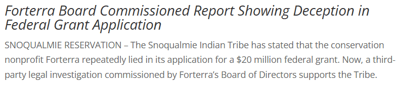
“The Snoqualmie Indian Tribe has stated that the conservation nonprofit Forterra repeatedly lied in its application for a $20 million federal grant.”
What rapid growth could mean for Roslyn
#leaveroslynalone
#peoplebeforeprofit